The AirCare app shows air pollution, active fires, wind conditions and pollen levels on a map.
CNBC
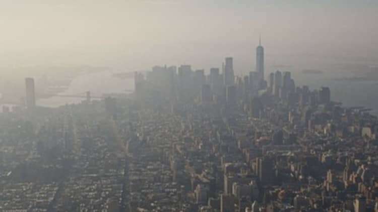
While air quality in North America and Europe improved over the last decade thanks to stricter environmental regulations, extreme weather and record wildfires have raised new air pollution concerns.
This week, smoke from wildfires in Quebec and Ontario drifted across the Northeast U.S., with an orange haze descending over New York City and unhealthy air quality levels persisting in the region.
As a result, more people are turning to mobile apps to understand when air quality is improving or worsening, wherever they may be.
As of Thursday, the Airnow mobile app ranked as the sixth most downloaded free app on the App Store for iPhone, outranking TikTok, WhatsApp and Instagram.
Use of these apps and new installs are often driven by regional events.
Generally, air quality tracking apps use a mix of data from government-operated satellites, weather, fire and ambient air quality stations, as well as sensors and systems run by private sector entities to track smoke and pollution levels. Some apps run on data crowdsourced from relatively affordable air quality sensors sold by companies such as PurpleAir and IQAir.
Air quality apps and maps
Outdoor air quality-monitoring apps like AirNow, AirCare and AirVisual have been among the nation’s most used apps in past years when wildfires raged in Oregon and California.
Here’s what those three apps do:
- AirNow also has online maps to give the public actionable information about air pollution at any U.S. ZIP. These include a Fire and Smoke Map, which provides information on fire locations, smoke plumes and air quality, and the AirNow Interactive Map shows ozone and particulate matter from air quality monitors across the country. While particulate matter (also called “PM 2.5” or “particle pollution”) is the key pollutant in smoke, ozone also can be elevated during wildfires.
- AirCare, made by developers in northern Macedonia, is available for iOS and Android mobile devices, including iPhones, iPads, Apple Watch and Huawei smartphones, among many others. Tiers include a free, ad-supported version and a pro version that costs $39.99 a year. The app includes kid-friendly air pollution information, charts and maps that show pollutant levels derived from government-run sensors and stations, alongside volunteers’ PurpleAir and other sensors throughout the U.S., Europe and Australia. In some major metro areas, the app also tracks ultraviolet and pollen levels.
- AirVisual, made by the Swiss air quality company IQAir, tracks air pollution in more than 10,000 cities and 80 countries drawing on data from tens of thousands of sensors, some positioned at U.S. embassies overseas. The company’s free mobile apps are also ad-free and available for iOS and Android devices. Besides real-time maps that show levels of six different types of major pollutants, IQAir’s AirVisual and mobile website provide seven-day air pollution and weather forecasts, along with air pollution-related news and health information. The apps can pair with the company’s own sensors, including the portable AirVisual Pro sold for $299.
The South Coast AQMD app shows air pollution levels in Greater Los Angeles.
CNBC
How air pollution impacts health
Air quality monitoring and measurement are critical for public health, according to Yanelli Nunez, an environmental health scientist who conducted her postdoctoral research at Columbia University’s Mailman School of Public Health.
She notes that robust studies have shown that air pollution contributes to lung cancer, chronic obstructive pulmonary disease, and lower respiratory infections — and even impacts mortality, pregnancy outcomes and cardiovascular disease.
Working in an environmental health sciences laboratory with scientist cohort Marianthi-Anna Kioumourtzoglou, Nunez said, their research also found long-term exposure to air pollution can affect the nervous system and may influence functions such as memory or cognitive capabilities.
The scientists wrote in an e-mail to CNBC in 2021 that: “Americans living in poor air quality areas tend to be people of color or low-income communities. We are finally starting to pay more attention to these issues, which hopefully will lead to change. The air pollution composition is also changing.”
In one example, greenhouse gas emissions from transportation declined in New York City from 2014 to 2017, while commercial cooking emissions rose.
With increased wildfires, the scientists wrote, “The sources and composition of the air pollution mixture that we are experiencing could differently impact our health, so we need to better understand source-specific effects, especially for these newly prominent sources.”
Indoor air matters, too
While outdoor air quality is important, society doesn’t talk or do enough about indoor air quality, said Richard Corsi, University of California, Davis’ incoming dean of the college of engineering, currently a professor and dean at Portland State University.
Using pre-pandemic numbers, Corsi explained that the average American would spend almost 70 out of 79 years of their life domiciled inside of buildings. “Because we spend so much time indoors, even our exposure to pollutants of outdoor origin is dominated by what we breathe there, especially in our homes,” he said.
Pollutants of outdoor origin, which come from the likes of internal combustion engine vehicles, photochemical smog, refineries and wildfires, can get into homes and buildings when doors and windows are opened, when heat and air conditioning systems are used, or through other cracks in the building envelope.
Consumer apps and devices today don’t give users an absolute, precise measurement down to micrograms per cubic meter of a given pollutant, Corsi noted. But they’re very valuable for spotting trends and relative changes in air quality.
In addition, sensors set up indoors can work well to check whether protective measures are working to improve the air inside of a house, school or other building.
Especially during wildfire season, Corsi said, some other simple actions that can protect or improve air quality indoors include: wet-mopping floors and wiping surfaces so pollutants don’t accumulate, using HEPA or high-efficiency particulate air filters, and increasing the MERV or minimum efficiency reporting value of filters in central air systems in a house.