Grab your sweater, your rainboots and your umbrella — that large storm is bringing rain and cooler temperatures to the region throughout Monday.
The atmospheric river-fueled storm has already dumped historic amounts of water on San Francisco and Sacramento, breaking rainfall records and causing floods across northern and central California.
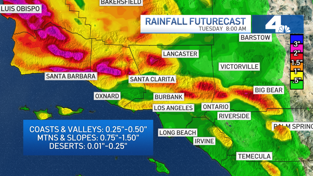
The same storm is expected to drop about .25 to .75 inches of rain over SoCal coasts and the valleys, and between 1 and 1.5 inches over the coastal slopes, foothills and mountains over the course of the day.
The rain will likely cause messy roads throughout SoCal, high surf near the coasts and even flash floods in the Alisal Fire burn scar area.
NBCLA SoCal will see its first solid soaking of the season on Monday, Oct. 25, 2021.
The rain will start to pick up around midday in Los Angeles and Ventura counties. The clouds will then sweep east in the afternoon, dropping water on the Inland Empire and Orange County during the evening commute.
By the evening, just after sunset, the rain should make its exit.
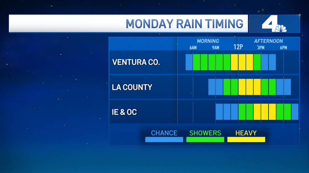
NBCLA The first real rain of the season should move out of the SoCal region by Monday evening.
Remember to slow down during the morning commute: because it’s the first rain of the season, the water will mix with oil on the roadways, creating slick, slippery surfaces as light rain starts to hit the western part of the region.
The heaviest period of rain may also cause some localized street flooding. Gusty winds may cause some difficulties while driving, especially in the mountains.
There’s a wind advisory in place for the mountains and deserts from 6 a.m. Monday all the way until 2 a.m. Tuesday, with gusts up to 55 miles per hour in some areas. Secure loose objects, like Halloween decorations, so they don’t fly away in the breeze.
Meteorologist David Biggar has the timing of the storm and explains when to be off the road Monday morning.
While most of the burn scars severe enough to cause mudslides or debris flows fall outside SoCal, the area of the Alisal Fire burn scar in Santa Barbara County will see some of the heaviest rain from the system.
With a flash flood warning in effect from 6 a.m. Monday until noon, county officials issued evacuation orders late Sunday morning for some residents.
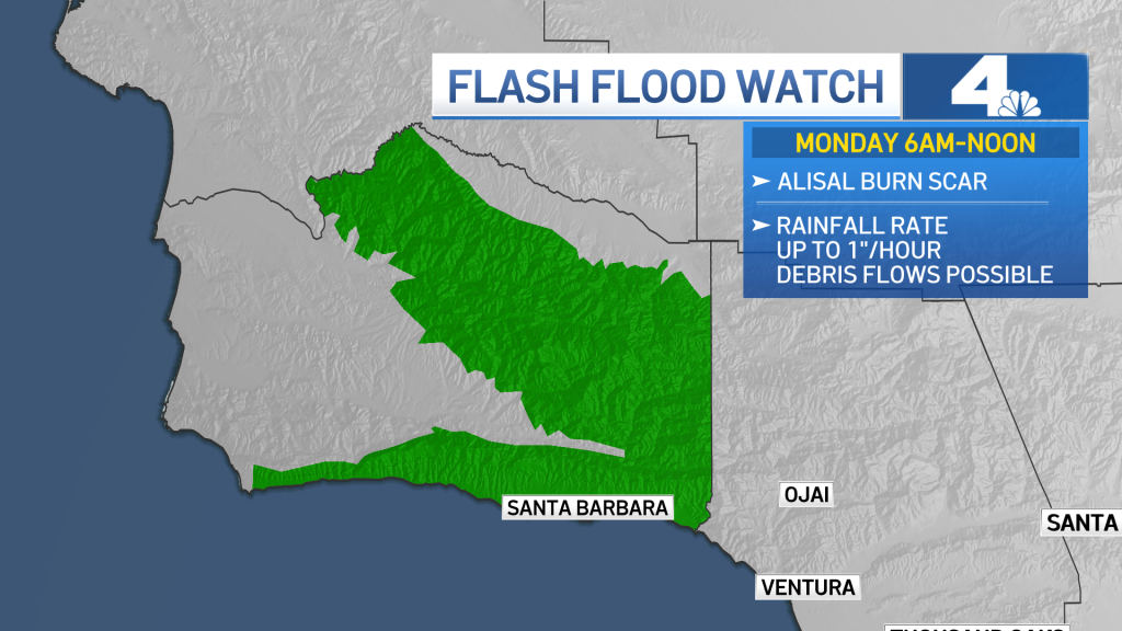
NBCLA Monday’s storm could bring flash floods to Santa Barbara County, which is particularly concerning for those near the Alisal Fire burn scar.
At the coasts, high surf advisories are in place, with waves as high as 6 to 12 feet.
Temperatures will stay cool as the rain system moves through the region, with highs only reaching the 60s. However, any snow is expected to stay above about 8,000 feet, due to the tropical nature of the storm.
Check back for the latest weather updates throughout the day.
